Le DeTour logo

Le DeTour logo

Sunday 21 September 2014

End of Detour

Guess where we were today....?

We had a comfortable night's sleep, and got up later than usual. We noticed the weather outside was foggy as we went down to enjoy large amounts of muesli and tea to fortify ourselves for the last stretch. Over breakfast, we had a good chat with a group including some Canadians, one of whom claimed responsibility for the good weather, as he'd last visited during the long, hot Summer of 1976! Preparing for the big finish, we were sent on our way by well-wishers from the breakfast group, and our hostess.

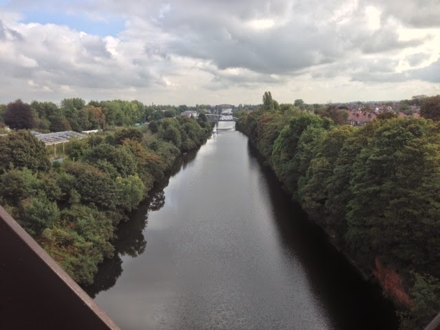
We got on the road by 9.45am, but had to put our lights on straight away due to the foggy conditions. First, we tried a short-cut which turned out to be a rough track straight into a farm yard, where we were met by friendly dog and a rather startled young farmer. He informed us somewhat pointedly that this was private property (though fortunately with no guns to back this up!), but then warmed up considerably as he questioned us and discovered what we were doing and revealed he was a keen distance cyclist himself, having done Land's End to Blackpool (End to Middle?). He eventually let us carry on, and we successfully rejoined the route close to the coast. At least we knew we were near the coast, but the fog meant that we couldn't see it, despite signs rather unfairly promising "scenic views". We realise that this means in 2 end to end trips, we still haven't managed to see this bit of coast, as it was foggy when we went the other way 10 years ago! We'll have to do it again in 2024 and see if it improves... Maybe with child support to carry luggage... Or would Pete and Roy like to rejoin the team to lend their support?

On the road

We carried on round through Hale, before turning North towards St. Ives. At this point, the mist lifted a little, so we had a clear run in, but still couldn't see the sea until we got to the viewpoint above the town. At this point John H was keen to carry on taking advantage of being on high ground and avoid going down into the town, but he was lured in with promises of Cornish pasties... We did manage to locate, and enjoy, a selection of Cornwall's finest pastry products, as we consulted the maps to work out the easiest road climb out of St. Ives. Route chosen and fortified, we set out. At this point John H discovered that he had been suckered as we rounded a corner after going along the northern bay sea front to be confronted by a wall of tarmac - a hill of at least 20%, and possibly 25% in places. JR and JC managed to struggle to the top (actually, it was a breeze, they say in retrospect - though that may have just been the heavy breathing). John H then had a problem with physics. His bar bag attachment had broken, so he'd stashed it in his rear pannier, and this probably contributed to his bike attempting to perform wheelies at this point. He got off, had a think, and got back on with a new, forward crouching stance to put more weight on the front wheel, looking like a performing frog in distress. Thus positioned, he eventually joined the other 2, who were by now waiting in hysterics at the top. JH arriving at the top, "If that was the gentle slope, I'd hate to see the steep one" (amazingly polite in the circumstances, possibly due to the @!**s being used further down the slope).

Tin mine looming out of the mist

Climbing out took us back into the fog, which meant that the area's famed tin mines loomed out of the mist in wonderfully eerie shapes as we passed. We carried on round unable to enjoy the views, eventually arriving in St. Just, to enjoy the 17% climb into the town, (JH says he did enjoy it - as it was a doodle in comparison to the previous one - which was maybe what inspired him to pop into the local coop to buy a bottle of champagne, quickly stashed in JR's pannier). With just one more down and up it was relatively flat all the way to the finish, which we hit at 2.05pm - just 5 minutes after our eta. We were surprised to be greeted by the gate-keeper as he cleared the way for us, when he said, "You'll know the way from here. I gather you've done it before". He'd had a chat with Tracey (wifiepedia No1), who was waiting at the finish for us, with JR's sons - Ash and Rowan. They greeted us enthusiastically as we crossed the line, plying us with more champagne and a carrot cake decorated with... bananas!

Celebration Cake

We finished the obligatory pictures at the signpost and more Cornish pasties, before cycling back to Penzance in a leisurely fashion, for a slap up meal and 1920's Jazz in a 500 year old hotel that JR's family are staying in.

Pictures at the signpost.
It's finished!

Cheers! Thanks to Katie and Marc for the champagne.

On the train on the way home after the ride, John H was moved to poetry.


End of Detour - a poetic epilogue. 

Our epic journey is now finally at an end. 
Cycling from John O'Groats to Lands End. 

Three old(ish) men on the JOGLE. 
To some we made minds boggle. 

Because LEJOG we had already done. 
Le Detour we called it and we won. 

JRs navigation kept us, mostly, on track 
For good route finding we did not lack!

Fog, mist, black clouds, rain, wind and hail. 
But with fortune mostly sun did prevail. 

In to Scottish headwind at the start. 
But lucky tail wind mostly from Tarbert. 

From YHA and wood hut to bunkhouse. 
From hotel and pub to John's house. 

Calorie and banana intake certainly rather a lot. 
But also occasional welcome beer and whisky tot. 

Bikes served us well and kept us right. 
Except chain, gear cable and light. 

At end, with our countryside we remain really smitten. 
As we truly conquered the length of Britain

Deer, dolphins, red squirrels, seals and stoat - wildlife abounds. 
Raptors, snakes, slow worms, mice, even otter sounds. 

Loch, lake, glen, dale, river and brook. 
"Spectacular" scenery wherever we look. 

Tumultuous peaks and mountains to top. 
Geology also abounded at every outcrop. 

We rode it all, over 11 hundred miles. 
No wonder when finished we couldn't hold back smiles. 

Moreover great to be with best friends throughout. 
The joy of cycling left in no doubt. 

At end cake and champagne to greet us. 
We never let any of those hills and valleys defeat us!

John H
21 September 2014


Final thoughts

JH - concludes that Britain is still a green and pleasant land (he's had a generous post-ride whisky)
JC - concludes that it's time for bed.
JR - says so long, and thanks for all the bananas!

Stats for the day
Distance 36
Average speed 11.2 (max 35)
Total climb 817 m
Energy 2035 cals

Bananas
JC 3
JH 2
JR 1


Saturday 20 September 2014

Cornwall at last!

Day 15 Friday 19th Sept

This morning we awoke to strong winds, fortunately easterly, and a grey overcast sky. After an delicious breakfast, we were away by 8:45 am. The first 3 miles were all down hill on an excellent road with a tail wind, so we thoroughly enjoyed that. Then we were into the up and down rhythm that would see us through the rest of the day. We very quickly passed our last county border; Cornwall greeted us just outside Launceston. In contrast to 10 years ago, we found a quiet relatively flat route into the town, with splendid views of the castle, bringing us out at the northern edge right next to a Spar, where we bought food for the day. We had some mini pasties as a minor celebration of both being in Cornwall and of passing 1000 miles (see yesterday's post). 

First sight of Bodmin Moor

Then we were off with a climb out of the town and on to Egloskerry. The road stayed relatively high, so not too much rise and fall for a bit. We joined the A395 for a short and unpleasant stretch, turning off at Hallworthy where we almost literally bumped into the JOGLE riders we had met in Ludlow (see day 12).  Had a brief chat and worked out that they will be likely to finish at a similar time to us, so we'll be on the lookout for them at LE.

On the edge of Bodmin Moor

The loop of road that we then took, put us right on the shoulder of Bodmin moor. We had a great view of some of the peaks, but also over an expanse of relatively flat moorland. There were sheep and loose horses, as well as horses being ridden. Part of the road went through an old set of giant runways, both of concrete tile construction. Again, with a tail wind, we sped easily over this section. 
After the wilderness, back in to the melee of the A39 for another short and unpleasant stretch to Camelford where we took a quieter road. This was a route that took the high ground, with views over the Camel valley, a strange road that didn't really go through anywhere. At this stage we were looking for a suitable place for lunch. After some time we decided that there must be a tax on benches, 'cos we hadn't seen one for about 20 miles!

We eventually stopped for lunch in Ruthernbridge, at the bridge in the centre of the village over a small gurgling stream. No bench here either, so we sat on the wall of the bridge, usefully graded in height, for long legs at one end to short legs at the other - just right for our group!

After a while, John C was demonstrating to me a problem he was having with his gear change, when the cause of the problem became apparent when the gear cable snapped. The broken end was frayed, suggesting that it had been on the way out for a while. Unfortunately the broken head had wedged itself in the gear mechanism, so we spent about 15 minutes getting it out. There was a small cheer when we finally removed the offending item. Fortunately John C had a spare cable, although I think it was made for an extremely long tandem, since it stretched most of the way across the road! We fitted it and were ready to head off, delayed by only half an hour. Not quite Tour de France mechanic speed, but not bad in the circumstances.

Roadside repairs on John C's bike

The offending snapped cable head

JR can't bear to watch as apprentice John C finds out how 
long his brake cable is!

We'd stopped for lunch in the middle of one of the most up and down parts of the whole journey, on exactly the same route that we had taken 10 years ago. When we came down the particularly steep descent near Nanastallon, John H was full of reminiscences about the joy and satisfaction he had had when doing it as a climb previously (I might be telling tales there though...).

We went through St Wenn and then on to St Columb Major, where we raided the shop for more food and water (the first time we'd had to buy extra water during the day on the whole trip, showing how hot it was and how much hard work it was today).

Carrying on, the day now became a bit of a slog as we moved into early evening. A look at the maps suggested some route changes; we just had a couple of extra miles on the A3075 to do and then we could cut through to our destination, saving a few miles and a fair bit of climbing. Whilst coming up a particularly steep climb on this road, John C had a bad gear change and couldn't get his left foot out of his cleat quickly enough, so toppled over. Finally we found a use for the high banks of the roads in this area! John C ended up propped up at an angle at the edge of the road. After a brief struggle, he was up and on with the climb with only his dignity slightly bruised.

Eventually we made it to our destination, again rolling up with lights on at about 7pm. We're staying at Illogan YHA, which is a bunkhouse hostel. The lady who runs it was very pleasant, chatty and helpful. We ended up having an excellent meal at the local pub before returning here to write the blog.


ONE MORE DAY TO GO :-)

On the road - what do we talk about
We obviously spend a lot of time together on the road, and whilst there is a lot to be done during the day (traffic, food, navigation, food, the condition of the road ahead, food etc), we do also spend some of the quieter moments in general conversation. It might be about something we've just seen - there are some fantastic place names and all sorts of conjecture is possible with places such as 'Unthank' (near Carlisle - suggestions welcome) or Portgate (some scandal with Port happened there perhaps?). We found ourselves involved in the Scottish referendum quite a bit in the early part of the ride, especially with all of the YES notices around the highlands. Sometimes we have some serious discussions about, for example;  the state of the world, the country, whether wind generators are a good or bad thing, the finer points of Jeremy Clarkson's popularity. Although we don't agree on all things, it's always in good humour, and there is generally a lot of laughter and leg-pulling going on.

Favourite moments from yesterday for all of us was the Meldon viaduct without a doubt.

Quote of the day
On hearing that the official traditional riding distance for a JOGLE is 874 miles, in the context of our 1000+ miles, John C said "you must have gone wrong a lot JR", referring to my navigational skills. (I knew we should have turned left and not right out of John O'Groats.)

Stats for the day
Distance 78
Average speed 11.5 (max 38)
Total climb 1735 m
Energy 4387 cals

Bananas
JC 6
JH 5
JR 4
We cleaned out the shop in St Columb Major!


Thursday 18 September 2014

Murky day in Devon

Day 14, Thursday 18 th Sept

The weather today has been very humid and murky; to the extent that we've struggled with photos. It has also made the cycling a bit uncomfortable, we have been going along feeling decidedly dank today; normally you get cooled by the breeze as  you go along but not so today. Not that we can complain about the weather, still only one day of serious rain since we started and today was another with a good, helpful tail wind.


John H eating blackberries at Bloom Hill

 We started out from Bridgwater relatively late after deciding to wait for the traffic to clear, so we were able to be a bit more relaxed than usual getting ready. On the road at 9:40 am we made steady to rapid progress further along the A38. The only time we came off this road was In Taunton, where our route took us on to the Bridgwater and Taunton canal. This was a delightful experience, revising John H's opinion of the place. The surface was good and we went through pleasant suburbs, past the cricket ground (game in progress) and in to the centre in pleasant, tranquil conditions. We eventually had to give up this pleasant progress and transfer back to the noisy, busy A38. Beyond Taunton we crossed in to Devon; quite a moment actually as we suddenly realised that we only had one more county left.

Cycling down the Bridgwater-Taunton canal 

We finally broke away from the A38 just about at its end (we'd done almost it's entire length from Bristol, starting the previous day) and headed through Cullumpton. From here our route changed character, being much more and steeply in and down, through steeply banked narrow winding lanes.

We lunched at the pretty village of Bradninch after an impressively steep descent. We all remembered stopping here 10 years ago. We were immediately greeted by the local publican offering to fill our water bottles. After a pleasant half an hour, we then headed on, crossing the river Exe and then on to the village of Bow. At various stages the sun tried to break through, but although it became warmer, we only ever had brief glimpses through the murk.

Railway route nr. Okehampton 


Country lane on the last stretch towards Okehampton

As we headed ever closer to Okehampton, our ultimate destination, John H 'bonked'. Now, before anyone gets upset about my unnecessarily crude language, I should point out that this is the official cyclists version of 'hitting the wall'. John had run out of immediate energy. We stoked him with some flapjack and other bits and pieces, before continuing. Finally we rolled into Okehampton. But our Travelodge was about 2.5 miles further SW along the frantically busy A30. Fortunately we had picked out a route that used an old railway line. Slightly trepidously, since our previous experiences with such routes had been a bit mixed (see Day 10!), we followed the signs to this route (The Lydford Line, or NCR27). Inevitably this involved a serious climb up through the posh side of Okehampton. Eventually we were there, and it turned out to be the 'best surface ever'. Smooth, wide tarmac, and well labelled too. So off we headed, enjoying a view of Okehampton castle on the way out. But the best was yet to come; we reached the Meldon viaduct, a high span over deeply incised land, and giving splendid views of Dartmoor and the Meldon dam. From there it was a short way to our Travelodge. And then the sun finally came out ...!

Meldon Viaduct

Dartmoor from the Meldon Viaduct

View of Dartmoor from outside our rooms
One thousand up, or is it?
Depending on whose trip computer we use we have either done just 1000 miles together, or about 990 miles. Either way, by mid morning tomorrow we will definitely have reached the magic 1k since we left London. Quite an achievement we think, but we'll wait until we have finished the entire trip before we celebrate. It's interesting to think that it is longer than many peoples entire JOGLE / LEJOG.

One day out, for some
When we checked in here at the Travelodge in Okehampton, we were told by the receptionist that he sees a lot of cyclists staying here. Apparently many of them do the trip from here to Lands End in one day. At first we were a bit taken aback, but then we realised for a lot of the cyclists doing a JOGLE, they do the ride supported (ie their baggage is carried for them, as it was when we did the LEJOG 10 years ago) and they do much of the route on main roads. We're very happy to be doing the scenic version, as there are so many things we would have missed; for example today there would have been no Bridgwater   to Taunton canal and no Meldon viaduct. Lands End from here is a pretty impressive achievement, however, so we applaud those that manage to do that.

Shorts returned
Those of you that have been following the blog for some time may remember that John C left his two favourite pairs of shorts (I'm still working on finding out their names) in Oban youth hostel. Well done to the staff there, as they have now turned up at home. It's very rare for someone's shorts to finish the journey first though!! 

It's official, we're bottomless pits
So said the waitress tonight, who cannot believe how much food we are eating; admittedly we have had two mains each instead of a starter and a main. "You've had as much as most people have in a week", she reckons .... We're about to have pudding.....

Stats of the day
Distance 66 miles
Average speed 11.3 (max 38)
Total climb 1537 m
Energy 3772 cals

Bananas 
JC 4
JH 2
JR 2
That's the most bananas since yesterday! (just checking to see who reads this bit:-)

Wednesday 17 September 2014

"How to get out of Wales with three bicycles"

Day 13, Wednesday 17th Sept - Two weeks since we set out from home!

We started the day at John H's house, having breakfast whilst the kids got ready for school. Sensibly, we'd left the bikes loaded in the Defender, so when we were all ready to go, it was a case of replacing the baggage and stowing ourselves in the various 'spaces' between. An uneventful motorised journey completed to return to last night's finishing point on the road, we unloaded and reassembled the bikes and their various bits of kit and headed off with Fiona's best wishes in to what we expected to ba a long hard day.

At the start of the day, the Three Desperadoes about to leave Ross on Wye

In a repeat of the previous evening, we started the day following the Wye river, before a severe climb out into the Forest of Dean, briefly, before then descending to the Wye again, rejoining at Redstream where we stopped for second breakfast. Here John H did a quick shop so we had some basics for lunch, including a locally baked loaf (which proved to be delicious). Then we spent the rest of the morning and early afternoon winding through the sun-dappled Wye gorge, surrounded by trees and glimpses of glorious scenery, houses perched high and very little troubled by traffic. We stopped briefly to admire Tintern Abbey, before eventually climbing out of the gorge and heading towards the Severn Estuary. We passed Chepstow Racecourse and grazed the outskirts of Chepstow itself. 
Old bridge at Redbrook in the Forest of Dean - old tin mining area 

The two Johns enjoying the sun dappled Wye valley.

John H passes Tintern Abbey, Wye valley.
Perversely, we were now following signs towards the M48! As we neared, we picked up the cycle route to the Severn Bridge. Finally, the bridge loomed before us, at which point the two Johns, bewitched no doubt by the sight before them, started up the hard shoulder of the motorway itself, instead of following the signposted route that was also de-marked by red Tarmac and big painted bicycle signs. Fortunately I spotted their mistake and was able to call them back; rescued by 'Dad' apparently (I like to think this is a fond reference to my natural air of common sense and responsibility and by no means a suggestion of any greater apparent age than them ....)

John C joins the slip road of the M48 !

Tunnel before Severn bridge crossing
We thoroughly enjoyed crossing the Severn Estuary on the 'old' bridge, offering great views all round under clear skies. It was astonishing and slightly unnerving to feel how much the structure vibrates and moves in response to the heavy lorry traffic. We finished the crossing and then followed NCR4 through the countryside towards Bristol; a great route only slightly confused by the multiple iterations of the route!

The Johns on the Severn bridge.... making use of the free wifi!

JH on the Severn Bridge

We ended up at Blaise Castle country park, where we had lunch before winding through the delights of Coombe Dingle; a deep-cut mini-gorge, filled with green, through suburban Bristol. The only down side to this route was that, although used by many cyclists, the stile at the end / start is too small for laden bikes. 

Lost in subterranean Bristol

 JR and John have different but equally inadequate methods, of negotiating their way off the cycle route in Bristol .

Method 1

Method 2

We ended up at the Avon Gorge, passing under the Clifton suspension bridge, before negotiating a complex route over and under the roadways around the place where the A4 crosses the Avon river. We had a bit of a shock to the system when we tried to join the A38 at a gyratory; then the road itself was ridiculously busy for the first few miles, only quietening once we passed the airport. We eventually stopped in Churchill at the Churchill Inn for some long cool drinks and bowls of excellent soup (except they messed up the order and John H made do with a banana). 

Clifton suspension bridge
Then we blasted on in the growing dusk, still 20+ miles to do. With quieter roads and a tail wind, we coursed along at ~20mph for a while. Lights on, we covered the last few miles at a gentler pace, extra vigilant in the traffic around Bridgwater itself as the driving became more impatient and less considerate. We arrived finally at 7:45 pm, our longest day yet completed, ravenous (no, really, more than usual) and tired; an interesting set of competing bodily demands. Of course hunger won out!


Forgotten tail
Something I forgot to note from day 11 (please refer to day 12). We were going quite fast on a nice downhill section whilst winding thought the countryside. John C was leading with me not far behind. Suddenly there was a blur of fur as a squirrel (grey) tried to dash across the road, but hadn't reckoned with our quiet bikes. It ended up almost making it between John C's two wheels - there was no way he could take any avoiding action, it was all too fast - but got its tail run over by the back wheel. After a shocked moment, it shook itself down and carried on, apparently unharmed ....

West is best
We've just realised that our furthest point west of the trip, assuming we complete, will have been Tarbert on Harris (6.8 deg. W, day 3) and not Land's End (5.7 deg. W)

Stats of the day:
Distance 83 miles - longest yet
Average speed 12.1 (max 40.2)
Total climb 1236 m
Energy 4267 cals

Bananas
JC 3 
JH 4 
JR 3
One of our highest banana counts of the trip, reflecting the very long day.


Tuesday 16 September 2014

Wye oh Wye

Day 12 Tuesday 16th Sept

One of the things that makes the blog particularly difficult is remembering what happened during the day. Fairly basic stuff you would think  (especially for someone of my age, no doubt some of you are thinking) and not necessarily something to make a fuss about. But it is more than the odd 'senior moment'. We're all finding that it is very difficult to even remember the day of the week, let alone what we did where and who said what. It's probably, we think, because our brains are fully occupied, processing the new things and places we are seeing, whilst all the time dealing with the business of cycling (checking the road ahead for potholes, looking at the traffic, navigation, assessing the latest pain, taking in the views) all this while coping with the never-ending craving for fooood. 

During a normal day, we're up early to pack and sort our bags (always difficult as we have such a small amount of space to deal with), then eating breakfast, before cycling. Generally we'll be on the road for 10 to 12 hours, then when we've arrived we need to shower (!) then probably do some hand washing of kit before heading out for more food. By the time we've done that it is often after 10pm and we're all ready for sleep, but will generally sit down and go over our maps looking at tomorrow's route. At some point in all this, I need to squeeze writing the blog. So, it's all pretty full-on.


Shropshire rural road rolls into the distance

Today when we set out it was foggy and cold, so it was lights and reflective gear. We had heard the news that another JOGLE rider had been killed on the roads in Scotland, so we were feeling a bit low. The fog was patchy and beginning to lift as we flitted through the Shropshire country side, giving the whole landscape an ephemeral character, with brief glimpses of hills, ridges and trees. We rolled in to Church Stretton, where John H quickly identified a Cafe that we had stopped in 10 years ago; it's now called Ginger and Green. So we went and had an excellent second breakfast!

Coffee house in Church Stretton where we also stopped in 2004

When we came out, the world had changed! Blue skies greeted us (we'd only been in the cafe for half an hour, honest). So after a quick application of sun cream, we were off, now able to see the beautiful hilly scenery around us. We went straight in to a steep climb up towards Hope Bowdler, then meandered towards Wenlock Edge which was to be our next challenge. We had a slight navigational incident as we turned off towards Hatton then realised that we were actually looking for Harton. One wrong consonant could have led us seriously astray.  A case of in-consonant navigation...


JR with Gaer Stone in the background on Hope Bowdler Hill

Then, as we started the climb, we noticed a sign at the side of the road "Road closed for 3 days for resurfacing from 16/9/14". Today? Once again we had been lucky with road works as it looked like the work team had not got there.

Top of Wenlock Edge

The climb was tough, but on the other side we plunged down into the most gorgeous valley, deeply incised and lined with trees, with scattered settlements that seemed to only have allowed buildings of character to be built; a real oasis of quiet and green. We rolled through this feeling better about life with every rotation of our wheels. Then we were out and moving on towards Ludlow, where we stopped for food (surprise!). Outside the shops we bumped into a couple of younger blokes who were also on a JOGLE; supported by the partner of one of them. We compared notes and swapped tails before wishing each other good luck.  May see them again on Saturday as they are also hoping to finish then. From what the support said, by then they too may be carrying their own stuff (for if we old'ns can do it, surely they can too?....).

Meeting another JOGLE rider in Ludlow

We had an excellent run out of Ludlow, boosted by bananas, sunny weather and good roads, making Leominster in what seemed like very short time. There, we followed signs to a picnic site next to the Priory that didn't exist, so ended up using a well placed bench at the Priory itself for a very large (too large infact) lunch, finishing off lots of bits and pieces. unlike Ludlow, our exit from Leominster was a bit sluggish, but we eventually settled in to steady progress through rural Hertfordshire, rich in agriculture and endowed with many magnificent trees, particularly oaks, their distal perspectives enhanced by a slight mistyness from the heavy, humid atmosphere. 

10 miles from our destination, at Mordiford, we stopped at a Pub for a nice cooling lime and lemonade, much needed, and then carried onwards over more hills to our destination at the services at the end of the M50, just short of Ross on Wye, where were due to meet John H's wife to be picked up. 

We had time for coffees and a hot chocolate before Fiona arrived. Then began the business of fitting the three of us, our bikes and kit into one Landrover Defender. With a bit of imagination and push we managed it and were off to enjoy the splendid and generous hospitality of John H's family.


Playing sardines in the Defender!

Quote of the day. John H on arriving at our destination: "if we went through Mordiford, which is on the Wye, and arrived at Ross on Wye, which is also on the Wye, then how come we just went over all those hills

Best bits
JH the rural splendour of Shropshire and Herefordshire
JC we had an excellent run out of Ludlow; the road had just the right amount of up and down, not too steep, to allow us to maintain speed.
JR going through the hidden beauty of Hope Dale on the southern side of Wenlock Edge.

Stats for the day
Distance 64 miles
Average speed 12.2 (max 35.1)
Total climb 1300 m
Energy 3531 cals

Bananas
JC 3
JH 2
JR 2

Monday 15 September 2014

The salt of the earth, a big lift and a bigger coincidence

Day 11 Monday 15th Sept

We had decided not to leave too early from Wigan to let the traffic ease off. So we had a relaxed breakfast before leaving at 9:30 with a light spray of rain in sunshine. We took a main road route out, heading south on A573. Our plan seemed to work as it was never too busy, so we made good progress through town after town, only really passing through proper countryside once (the sound of birds singing was notable here) before reaching Warrington. Here we went for a bit of Garmin navigation, so headed on a route that zigzagged through the centre and out, crossing the Mersey and Manchester Ship Canal n the process. 

The Manchester Ship Canal

Then we finally got off the main roads and were soon wending our way through the Cheshire countryside; agricultural with scattered dispersed villages. We quickly came to the Anderton Lift; this is a Victorian structure designed to move canal boats from the higher Trent and Mersey canal down to the Weaver Navigation, now restored to full operation. I had had the privilege of using this on a canal holiday a couple of years ago with family, but for the two Johns it was their first sighting. 

The Anderton Boat Lift, built in 1875


The team at the Anderton Lift - using some tricks from Lord of the Rings


Then onwards through Cheshire. At one point we went past huge piles of salt, presumably from one of the mines in the area. Otherwise it was steady progress through pleasant countryside. Bumping into Paul and Isobel Langton (see more below from John H) was an amazing coincidence.


The team negotiate a section of NCR 5 

We passed through Northwich, Nantwich,  Whitchurch and Wem, then headed on main roads due south towards Shrewsbury.  For most of the day we cycled in patchy sunshine, intense enough that we took advantage of the shade of a Millenium Oak when we stopped for lunch. But an ominous black cloud seemed to chase us for much of the afternoon and we were briefly scattered with heavy rain drops. But in the end we came into Shrewsbury dry. The town looked fascinating with it's red sandstone castle and wooden beamed houses, but it was late and we were keen to arrive before needing lights, so we pressed through to the southern side, where our Travelodge awaited.

A bit short and dry today, but it was a day of making progress. Day 12 looks like being a tough one, and we will be following much of the original LEJOG route. Ross on Wye is the target for the day, a deviation from the original plan as we are to be picked up by John H's wife to spend the night in his house. It will be a relief to do a big wash before our laundry composts in the panniers.


Evening sun breaks through the black clouds which had followed us all day

Anecdote of the day
From John H: In North Shropshire we turned a corner of a remote lane and were greeted by two horse riders. Surprise! It was Paul and Isobel Langton! We were all amazed by the coincidence. Paul and Isobel kindly accommodated us for a leg of the 2004 LEJOG ride, as well as some other occasions since. By another coincidence John H had tried to txt Paul a couple of days ago but had found his mobile number had changed and his old number was now used by somebody else (a complete stranger) who returned the txt by wishing us all the best for the ride! We worked out that if we had been 1 or 2 minutes earlier on the road we would have missed Paul and Isobel entirely.

Bumped into Paul & Isobel (almost literally) when they were out for a ride,
totally unplanned

Quote of the day
John H on arrival at Shrewsbury "I'm a lot better on three bananas"

Taday's stats
Distance 78 miles
Average speed 12.2 (max 30.9)
Climb 936 m
Energy 3831 cals

Favourite bits
JC: finally finding an open WC in Wem at the third increasingly desperate attempt ..... Eating enough to fuel 3831 cals - we'll leave the rest to you ...
JH: Anderton lift, a fantastic example of Victorian ingenuity - real engineering
JR: revisiting several of the canals that I've been on over the last few years

Bananas
JC 3
JH 3
JR 2

Sunday 14 September 2014

Tree mendous cycle paths and other stories

Day 10 Sun 14th Sept

We spent a lot of today's route off-road on what proved to be an eclectic mix of surfaces. This was in an attempt to get through an area of the country increasingly full of towns, cities and roads. A far cry from our days in the highlands where we could go for miles without seeing another soul. Some of my concerns about the day were bourne out. Off-road routes, even if they are part of major NCR (national cycle routes), can be poorly surfaced, inconsistently labelled and in some cases far worse than being on the road. We saw all of this today and more!


Our bikes prop up the bar at Whoop Hall

After breakfast, we retrieved our bikes from their luxury accommodation and got on the road. The day started cool and overcast as we headed towards Lancaster by a direct and rather good road across rolling countryside at the edge of the Pennines. As we came into the outskirts of the town, we picked up the Lancaster canal at the impressive Lune aqueduct, then down onto an excellent cycle route along the banks of the Lune itself. This took us right through the town and out the other side, including a brief stop for food where we had a nice chat with a cycling lady who had done a Lands End to Lancaster cycle ride. Definitely an example of how to do off road routes here. 

Lune aqueduct nr. Lancaster

On the way through we saw lots of city regeneration. Here, John C could not resist a run around a BMX park on his fully laden bike, until his front panniers popped off that is. John H was finally mollified after the Stornoway incident (see day 3!). Little did we know that we would all need some of these skills later.....


John C plays on the BMX course in Lancaster until his pannier came loose!

The route merged with a disused railway and carried on down the coast to Conder Green, where I took the team on a brief detour for some excellent views of the coast (not a navigational error, honest)! We then continued on good roads, never too busy, but with noticeably less patient drivers. We crossed the A6 into Garstang, where we had a lunch stop, and then on, briefly along the A6 (which we had used for a lot of the route 10 years ago and resolved to avoid as much as possible on this one) before getting back onto quiet back roads. We were very conscious that we were making good progress south. Coming into the outskirts of Preston we tried to pick up the canal side route, but had difficulty initially before happening on a way on by accident. Here I took the guys on another detour, this time to see a short lock staircase. This canal side route was, however, not so good, having a rough surface, so we were quite pleased to come off it. By now we were using iPad navigation to deal with the complexity of the route and found ourselves getting through Preston quite effectively. We had a brief chat with a bloke who wished us luck given that the ring road came through the town centre!

JR enjoying the run from Kirby Longsdale to Lancaster

We were heading to pick up NCR55 which would provide, we hoped, a backbone to our route for the rest of the day. As we headed towards its start I took the guys on another detour for views of a park.... Eventually we found the start, which was very encouraging as it took us across the river on a high viaduct then on to a tree-lined run across open countryside. Perfect! 


Great cycle path south if Preston - but it soon got hard going

But all good things must come to an end and it wasn't long before we were zigzagging along short bits of quiet road, up and off pavements and across side roads all whilst keeping a look out for the next sign. We ended up going through a country park, which was nice, before we briefly abandoned and headed down on the road again, fortunately quiet on a Sunday afternoon. We had a stop for hot chocolate where JR finally atoned for chocolategate! Then in one final go on NCR55, we joined the tow path to the Leeds and Liverpool canal. This was an excellent tarmacked surface which had unfortunately been laid on very rough ground, resulting in us and the bikes getting a bit of a pummelling. 

John H negotiates a stretch along the Leeds Liverpool canal before really
going off road ...
We left the canal at Adlington supposedly to join a disused railway route. No sign of signs. Then we came across a young man, possibly slightly the worse for the can of beer he had, but with a bicycle. We asked if he knew of a cycle route and he did. Following his directions, we headed down a grassy bank then along a dirt track (this is where the BMX skills came in handy), up a very steep stony track before getting onto what was indeed our route; NCR55 signs confirmed it. It was as if they were trying to hide it. This stretch could have been very good, with a bit of care and a good surface. We were lucky it was dry as we could see that it would be a mud bath in the wet. The final ignominy was when we came across a fallen tree right across the route. We could just squeeze past by going in to the ditch. That was it, we'd had enough of route 55! As soon as we could it was on to the roads with a smooth run in to Wigan with no further problems.


Our "off-road" route is blocked south of Chorley

Quote of the day, nicked from breakfast on Monday:
John C on being reminded that it was an all-you-can-eat breakfast (a very dangerous thing with us): "I think I've done a pretty good job with that already".

Today's favourite bits
JC: the off-roading bit
JH: going along the canals and seeing the variety of the canal environment, particularly how different people embrace it differently
JR: arriving after a hard day's navigation! Otherwise the Lune aqueduct

Today's stats
Distance: 64 miles
Average speed 10.8 (max 33.9)
Climb: 780 m
Energy: 2931 cals